Yesterday I continued with my New River Walk, starting near Palmers Green Station where I had stopped in July! It was a sunny autumn day and the walk to Enfield (including the Enfield Loop) was pleasant and easy but with the usual signpost puzzles.

And then suddenly, and for no obvious reason, the path leaves the New River and diverts into Chimes Road, only to rejoin the New River again at Hazelwood Road for more countryside peace and quiet!


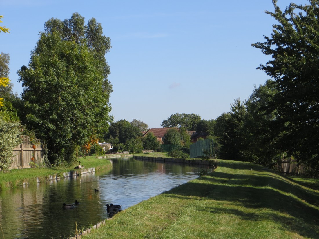
At Hedge Lane the path is diverted down River Avenue. Once back alongside the water at Barrowell Green we found this very assertive chap who cleared the water of all the Canada Geese to allow his family sole passage!


From Ford’s Grove the New River is wooded again, alongside Winchmore Hill Cricket Club. I saw a heron, but the photograph was not good enough, urgh!
 at Ford's Grove")


At Ridge Avenue the path is barred again and we walked up Bush Hill – no signposts anywhere! After about five minutes a gate (unmarked) on the left side of the road leads to the Clarendon Arch. Here the New River crosses over the Salmon’s Brook and originally flowed in a lead-lined aqueduct known as the ‘Bush Hill Frame’. The Arch, a vaulted brick tunnel, was built in 1682. It carries Sir Hugh Myddelton’s Coat of Arms (mainly lost in greenery) and was named after the Earl of Clarendon, a Governor of the New River Company. In the 1780s the Arch was extended and modified again to accommodate a road.


Steps, and a signpost, on the opposite side of the road led up to the New River which runs alongside Bush Hill, coming out on Bush Hill Road at an original sluice gate of 1796 which controlled the flow of the water, and the site of Halliwick House (1613) Sir Hugh Myddelton’s home. (The original building was not safeguarded and was eventually replaced by new housing by Laing Homes (c.2000?); more photographs of the original building are here.)


At Bush Hill Road I wanted to follow the Enfield Loop, the original course of the New River. A twisted sign post led me incorrectly down Quaker’s Walk and some interesting sights: the Water Tower of 1877 was an artesian well to supply the ‘new’ housing in Bush Hill, and was eventually taken over by the New River Company. It has been converted into private housing. The actual route was up Bush Hill to find the entrance to the Golf Course (another unclear signpost) and the path along Carr’s Lane. The lane is named after William Carr who owned Chase Park, a mansion and estate. The Golf Course was originally another private estate.


The Enfield Loop was made redundant in c.1900, when the New River was piped underground, and straightened. It is a pleasant circuit around the town centre.


And finally, in the town centre before catching the train to central London. (Old images from the Enfield Society website.)


You may be interested in
Diamond Geezer’s description of this section
Walking the New River
Stephen & Lucy’s Walks – some beautiful photographs
The Enfield Society has old photographs of Halliwick House
Edith’s Streets – a remarkable undertaking
Clarendon Arch – a photograph of the engraving on the arch, and here
Information about Enfield – interesting site with photographs
runner500
It is easy to forget that places like Enfield have some great old buildings, I think that I must have walked round part of the old Enfield Loop many years ago without realising that it is part of the New River.