The Islington Tunnel is only for barges so pop up and over and continue from the exit/entrance in at Muriel Street in the Barnsbury Estate. In this narrow tunnel the men had to ‘leg’ through the barges, as in the photograph from Dudley Museum.


Converted warehouses at Ice Wharf remind us of the ice trade in this area.

Battlebridge Basin was originally known as Horsfall Basin (or even Horsefalls Bason, after the owner, William Horsfall, who was also involved in the development of Pentonville) and then Maiden Lane Basin. The Canal Museum is on this basin, in an ice house which stored ice from Norway, imported by an ice cream maker, and for distribution in this area. Originally built for trade, the basin became derelict until redevelopment in the early 2000s, including King’s Place, opened in 2008 – what a change from the original purpose!

Maiden Lane Bridge carries York Way over the canal, and is apparently a corruption of ‘Midden Lane’, meaning ‘dung heap’!


Beautiful – she looks coy and he is doing the work!

St Pancras Lock, no.4, with Camley Street Natural Park hidden in the trees on the right of the photograph. The Park used to be a coal yard.


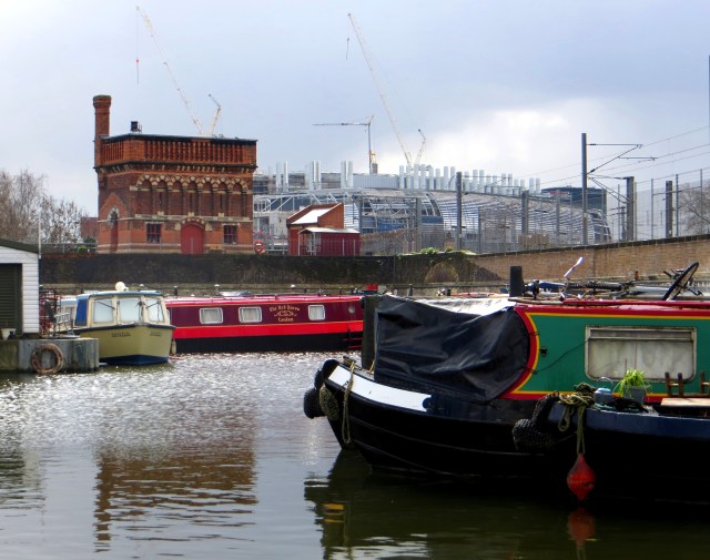
The brick tower is the St Pancras Waterpoint, built in 1862 by Sir Gilbert Scott to store water for steam engines on the railway! And just behind the canal and the station is St Pancras Old Church.
You may be interested in
Battlebridge Moorings – a brief history
Friends of the Regent’s Canal – interesting facts & figures
The St Pancras Waterpoint
Interesting article by the Chairman of Trustees, Canal Museum
The Regent’s Canal
When London became an Island

I would love to hear from you!